Powers massive-scale industry autonomy and sustainability projects
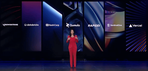
There’s nothing more powerful than hearing a customer share how the right data at the right scale can make a significant business impact for them and their clients. During Qumulo’s recent employee event in Seattle, Hexagon’s President of Geospatial Content Solutions, John Welter, gave a fascinating overview of how Qumulo has helped their company over the years. As a $4.3 billion global leader in digital reality solutions, Hexagon combines sensor, software and autonomous technologies that are the underpinning to many industries and businesses working to be more productive, efficient, and profitable. He emphasized how critical IT solutions like theirs, in concert with Qumulo’s File Data Platform, support a smart digital reality that helps their clients test a wide variety of applications in a virtual environment.
Creating a digital twin of the world to support industry autonomy
From construction to city services, and mining or federal government agencies, Hexagon captures reality by scanning environments on the ground or even below the water’s surface—a city, building, roads, infrastructure assets, indoor spaces—to see what’s important. They leverage the captured data to inform smart analytics, interpretations, and industry action. In order to do this, Hexagon’s Content Program utilizes 20 – 30 aircraft from their own fleet or operated by sensor customers that fly around the globe capturing geospatial data. Via their streaming platform, Hexagon’s customers consume more than 1 billion high-resolution images per month, their production teams use 2500-plus CPU cores in a typical cluster and processed more than 9 million square miles of worldwide data in the last eight years. They also expect to collect more than 48 petabytes of data in 2022. Hexagon’s geospatial data library grew from 150 gigabytes captured in the field per day and stored in 2002 to 160 terabytes now stored daily, processed, and quickly distributed to customers. “It’s two orders of magnitude that require scale. And on our sensor roadmap, the next sensor will have 40 percent more data without faster cycles or higher resolution,” added Welter. Sometimes, it is ingested and turned around for one of the company’s top customers in as quick as three days. “Our HxGN Content Program—the largest library of high-quality aerial imagery, elevation data, 3D models and analytics covering North America and Western Europe–has captured more than 27 million square kilometers in the last 8 years and is storing 4 petabytes of final product on the cloud. There’s a lot riding on it and we need to choose the right IT partners.” – John Welter, President, Geospatial Content Solutions at Hexagon. Hexagon customers, including government agencies, will continue to push for more, faster data streams and mission-critical insights. Why? They are confronted with mounting pressure on urban planning, from smart city applications, and when facing unexpected challenges like city and state-wide emergencies, noise and light pollution, or fast-growing populations. Hexagon is ready to address these demands, unforeseen problems, and more, because Qumulo and other partners deliver IT infrastructure that gives choice, flexibility, and reliability when handling the unstructured data and changing points of reference. The Qumulo partnership has “never felt transactional,” concluded Welter. Hexagon can rely on Qumulo’s round-the-clock support, storage choices (e.g., on-premise, cloud, or hybrid), and enhanced capabilities to achieve more productivity, creative business models, and engagement with communities or customers as solutions are brought to market and the company grows in the future. Some customers benefiting from the partnership with Qumulo are:- The Federal Emergency Management Agency (FEMA): During COVID-19, Hexagon turned on their data for FEMA to help them determine where to put testing areas, mobile clinics, and queue people in and out of hospitals.
- Texas Natural Resources Information System (TNRIS): Hexagon’s partnership with TNRIS paved the way for the Content+ offering, a licensing model that makes planning and budgeting easier for state governments. Via the Content+ initiative, TNRIS had the flexibility to capture statewide imagery to its desired specification and refresh cadence.
- Beneath the Waves: This non-profit ocean research institute which uses cutting-edge science to drive ocean policy, partnered with Hexagon for their aerial bathymetric light detection and ranging (LiDAR) scanning technology to measure seagrass meadows and establish benchmarks that will allow future comparison and improved ocean conservation around the globe.


